Map reading and navigation
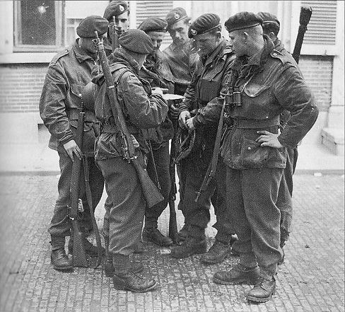
In the area between the River Arkaig on the opposite side to Glas Bheinn Mhor, and beyond the Chia-aig waterfall and forest, the recruits were taken on cross-country marches led by an officer and an NCO navigating on a compass bearing or picking his route using a map. The leader would set the pace, tramping in single file up and down mountains, over heather and swampy moors, through glens, across shallow burns and deep and fast flowing rivers.
Core Navigation Skills Taught
-
Map reading and terrain interpretation
Trainees learned to read military-style maps: contour lines, scale, grid references, and symbols, identifying features like ridges, valleys, rivers, roads, woodlands, and buildings -
Compass handling & bearings
Instruction included taking and transferring bearings, plotting compass courses, back-bearing techniques, orienting maps to magnetic north, and adjusting for magnetic variation typical of the Scottish Highlands -
Night and low-visibility navigation
Included stealth movements in darkness. Navigational training occurred day and night to prepare commandos for covert infiltration and terrain tracking during raids . -
Cross-country and patrol navigation
Trainees guided small teams over complex terrain—often under time pressure and stress—learning pace counting, terrain association, and estimating distance without GPS

Practical Training Methods
-
Fixed-point navigation exercises
Small teams navigated to predetermined map locations—hilltops, river fords, isolated glens—with limited instructions and rigorous time limits. -
Forced-map-and-compass marches
Long speed marches (7 mi in 60 min) included waypoints requiring navigation via map/compass between rally points -
Combined Arms & Amphibious Navigation
Integration with small-boat operations, beach assualts, and waterborne patrols. Ensured commandos could disembark at precise coordinates—even under darkness or obscured terrain -
Live-fire and night patrol scenarios
Map-and-compass navigation was paired with simulated enemy fire, explosions, and night-time patrolling to test mental focus and decision-making under duress
First hand Trainee Accounts
From U.S. Ranger trainee CPT Oscar Joyner’s account (1942):
“…night training was added… map reading and compass land navigation; explosive charge preparation… Speed marches… Ranger‑trained junior leaders…”
British trainees confirmed that:
“Navigation with map and compass was practiced on land and water, day and night… field expediency, live fire, and creativity…”